 |
This map is to show the location of the two St. Davids
Road Tunnels and is not meant to encourage trespassing.
For a better map, try going to http://www.mapquest.com Search for 800 Glendale Avenue, Niagara-on-the-lake, ON and then zoom out. |
| It appears that St. Davids Road
in Thorold, Ontario used to run all the way to St. Davids at the intersection
of Four Mile Creek Road and York Road in what is now the Town of Niagara-on-the-lake.
St. Davids Road was "cut off" in several places during the 20th century
by the 4th (present) Welland Canal and various highways. The parts of St.
Davids Road remaining to the east of Thorold are now called Warner Road.
However, St. Davids Road appears to have been an important thoroughfare in the 19th century. Tunnels were built to allow passage under both the Canadian National Railway (formerly the Grand Trunk Railway) and the old 3rd Welland Canal. Thanks to Mr. David Barber of The American Canal Society for mentioning these tunnels. |
 |
This map is to show the location of the two St. Davids
Road Tunnels and is not meant to encourage trespassing.
For a better map, try going to http://www.mapquest.com Search for 800 Glendale Avenue, Niagara-on-the-lake, ON and then zoom out. |
 |
Park on the shoulder of the road outside the G. M. Plant. If you drive onto private property you may get "locked in." | 
Proceed south on the gravel road to the Canadian National Railway bridge. |
 |
General Motors Plant as seen from the road. |
 |
See the map above for "how to get
here."
This is the south end of the tunnel that used to take St. Davids Road under the Canadian National Railway tracks. The original stone tunnel has been extended with a modern concrete tunnel to allow for a road as well as the C.N.R. tracks. |
 |
|
 |
 |
 |
See the map above for "how to get
here."
The west end of the tunnel under the old Welland Canal must be somewhere in this dense undergrowth. This area appears to have been flooded, but the summer and autumn of 2007 have been dry thereby allowing access this far. I will have to return later on in the autumn when there is less foliage - maybe we will see the tunnel then. |
 |
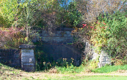
January 2008 The weather was finally cold and dry in January 2008 and I returned to find the west end of the tunnel. All that can be seen is the top of the stonework. The tunnel is most likely completely filled in. It is most certainly not accessible. |
 |
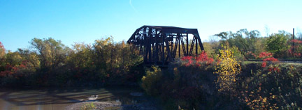
The old railway swing bridge (that no longer swings) over the abandoned 3rd Welland Canal. |
 |
The tunnel passes under this part of the old 3rd canal
as seen from the swing bridge. The wall of lock 16 can be seen. The water
level used to be much higher - close to the top of the bank shown on the
left and to the top of lock 16.
I strongly suspect the tunnel is either flooded or filled in. |
 |
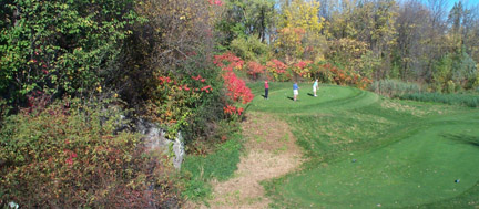
East end of tunnel as seen from the Royal Niagara Golf
Course. It is thoroughly blocked up with concrete and I suspect the tunnel
itself has been filled in. If not, it is probably flooded.
If visiting this site, remember that the golf course is most certainly "private." Be quiet and courteous, do NOT walk on the greens, and so on. |
 |
The stone abutments of the old tunnel are barely visible
from the side.
The golfers didn't seem to object to my presence; but I was attired decently and didn't make a lot of noise. Mother said: "Dress like an old bum and you'll be treated like an old bum." |
 |
Looking south from the old swing bridge into Lock 17. |
 |
View to the south of water pouring into Lock 16.
The tunnel passes under the water shown above Lock 16. |
 |
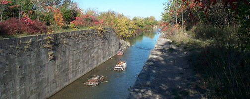
View to the north of Lock 16.
Some folks have left their vehicles in the old lock. This is not a good place to park. |
 |
View to the east of the Royal Niagara Golf Course as
seen from outside the fence at old Lock 16.
The golfers were friendly and helpful. |
|
|
|
|
|
|
|
|
|